1 ROYAL CIR
Owner Information
ROVNER TODD R & YULIYA M TRUSTEES
1 ROYAL CIR
LEXINGTON, MA 02420


Property Details
1 ROYAL CIR is classified as a Single Family Residential.
The primary structure on this property was built in 2014. There are 6,978ft2 of built area within this property.
1 ROYAL CIR is valued at $1,832,000. The land is valued at $683,000 and the structures are valued at $1,148,000.
This property is in Zone RO. Confirm with local Zoning Board authorities to ensure there are no overlays or other easements on this property.
The most recent deed for 1 ROYAL CIR is recorded at the local registrar in Book 72970, Page 0563. 1 ROYAL CIR was last sold on Tuesday, July 23, 2019 for $100.
Assessment data from fiscal year 2022.
Flood Data
According to the FEMA National Flood Hazard Layer, this property does not appear to be in a flood zone. It may also be in an area not yet reviewed. Nonetheless, confirm this information prior to taking any action.
To view the flood hazards around this property, create a FEMA "Firmette" Map of the area around 1 ROYAL CIR.
Broadband Internet Providers
| Provider | Type | Bandwidth (mbps) | |
|---|---|---|---|
| Verizon New England Inc. | DSL | 1 | 0 |
| Viasat Inc | Satellite | 100 | 3 |
| VSAT Systems, LLC. | Satellite | 2 | 1 |
| HughesNet | Satellite | 25 | 3 |
| GCI Communication Corp. | Satellite | 0 | 0 |
| RCN | Cable | 500 | 20 |
| Comcast | Cable | 1000 | 35 |
| Verizon New England Inc. | Fiber | 940 | 880 |
Broadband service provider data from December 2020.
Adjacent Properties
- 93 GROVE ST
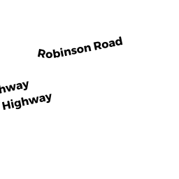
Single Family Residential owned by YANG WENLONG & - 6 ROBINSON RD
Other, Open Space owned by NORTH SHORE RESIDENITIAL DEVELOPMENT INC - 6 ROBINSON RD #2
Residential Condominium owned by XIE XIN & - 6 ROBINSON RD #10
Residential Condominium owned by BODAPATI SRINIVAS & - 6 ROBINSON RD #11
Residential Condominium owned by HODGKISS PHILIP PAIN - 6 ROBINSON RD #3
Residential Condominium owned by SPRECHER FRANK & - 6 ROBINSON RD #6
Residential Condominium owned by ELKHALIFA AMAR & - 6 ROBINSON RD #7
Residential Condominium owned by OH SECHANG - 6 ROBINSON RD #8
Residential Condominium owned by BAO ZHEN & - 6 ROBINSON RD #12
Residential Condominium owned by ALI RAHIM K & - 6 ROBINSON RD #5
Residential Condominium owned by GOLDBERG JAY D & - 6 ROBINSON RD #9
Residential Condominium owned by CHOI JIN HO - 6 ROBINSON RD #16
Residential Condominium owned by MANUKYAN ZORAYR - 6 ROBINSON RD #15
Residential Condominium owned by MANUKYAN ZORAYR